
Welcome to Big Bend
A self-guided interpretive experience
Discover Ancient Giants
Explore the Fossil Discovery Center at Big Bend National Park, where you can journey through millions of years of natural history. This state-of-the-art exhibit showcases an incredible array of fossils, including life-size replicas of prehistoric creatures. Visitors can engage with interactive displays, touch real fossil casts, and learn about the fascinating paleontological discoveries that make Big Bend a unique window into the ancient past.


Exhibit Highlights

Pride of Big Bend
-
The 130 million year fossil record preserved at Big Bend is one of a kind. Over 1200 fossil species have been discovered thus far in the park.

Fossils in the Wild
-
Fossil ammonites, oysters, snails and clams can be seen along many hiking trails of Big Bend National Park. Please take only photos so everyone can enjoy these treasures.

3 Places to see the K-Pg
-
The Cretaceous time period ended sixty-five million years ago with the extinction of the dinosaurs and the Paleogene period began. This transition is known as the K-Pg boundary and is preserved within the rocks of Big Bend.

Explore Geology
-
Along the park roads are numerous geology wayside exhibits that dive deeper into the park’s rich geologic history. Look for these pull-offs to learn more.
Learn more
The Exhibit
At the Fossil Discovery Exhibit visitors can experience the changes to Big Bend’s plants and animals, and the world they lived in, through 130 million years of geologic time. Specimens from Big Bend’s remarkable fossil record and full-color artwork help to illustrate the fascinating story of Big Bend’s ancient life.

Big Bend’s Ancient Life
-
The Story Begins
The story begins at a time when a broad, shallow sea covered Big Bend and much of Texas, leaving behind a fossil record that includes mosasaurs (swimming reptiles), predatory fish, sharks, and numerous “sea shell” fossils, such as clams, oysters, snails, and sea urchins.
-
Ancient Sea Recedes
As the ancient sea receded, Big Bend became a swampy, coastal environment, much like the coast of Texas today but inhabited by dinosaurs and giant alligators.
-
Dinosaurs Roam
Later, the coastline moved farther to the east, and Big Bend was crossed by rivers and forests, where dinosaurs roamed and giant pterosaurs soared overhead.
-
After Extinction
After the extinction of the dinosaurs, mammals flourished, including those whose bones were found just a stone’s throw from the Fossil Discovery Exhibit.
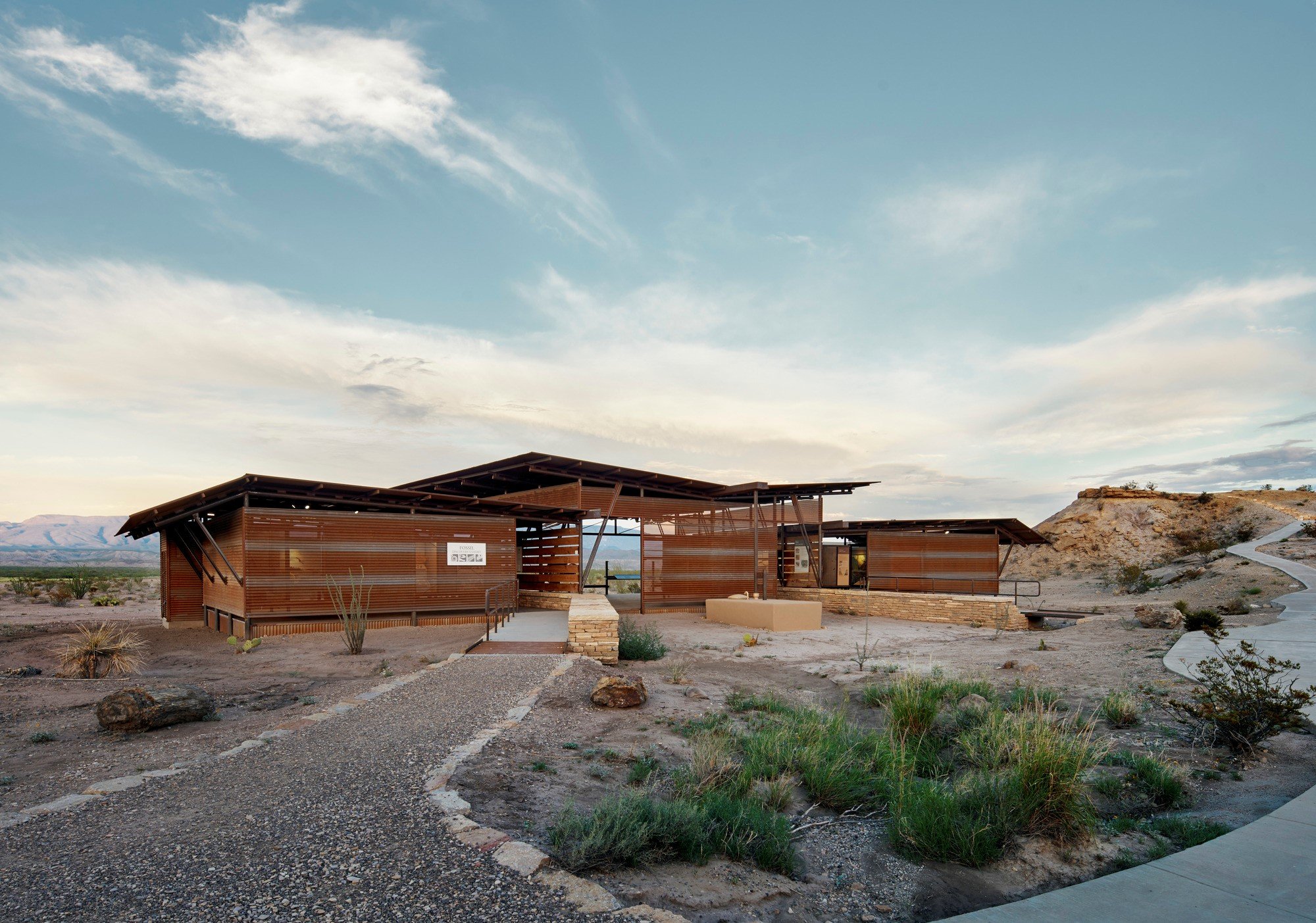
About the Exhibit
Located 8 miles north of Panther Junction on the Persimmon Gap Entrance Road (Highway 385), the Fossil Discovery Exhibit is a self-guided interpretive experience. The exhibit is open from dawn to dusk daily. A shaded picnic area is nearby, and it has an assortment of fossil-themed climbing structures for children. A vault toilet is available at the site (no water is available). Cellular telephones generally can get reception at the site.
The Fossil Discovery Exhibit is the most significant addition to Big Bend National Park’s visitor services system in the past 50 years. Thanks to the generosity of individuals, corporations, and foundations across the state, this $1.4 million exhibit will give park visitors the opportunity to meet the past right where actual fossils were found.


Ages of Rock by Ray Troll
What are Fossils?
Fossils are hints and clues about past life on planet Earth. Most people are familiar with big fossils such as the giant skeletons of woolly mammoths or dinosaurs, but fossils come in all shapes and sizes from all sorts of living organisms. What they all have in common is that they used to be alive, but have slowly turned into rock over lots of time, and they are at least 10,000 years old. Scientists have been finding fossils for hundreds of years, and this collection represents the fossil record. Tiny bacteria fossils have been found in rocks that are 3.4 billion years old! Trilobites are some of the oldest visible fossils and are approximately 540 million years old. Mammoths, saber-tooth cats, and giant sloths represent some of the youngest fossils known from the Pleistocene Ice Age.
How Fossils Form
-
![]()
Fossils can form in multiple different ways. The most well known process is permineralization. This occurs when a plant or animal is buried and over millions of years the mineral-rich groundwater slowly replaces the organic matter, leaving behind an exact stone replica of the original critter.
-
![]()
Casts and molds are fossils that form when an organism leaves an impression in the surrounding sediment but the original remains of the critter have been lost. A mold is the organism-shaped void left in the rock. A cast is when that impression is filled in with rock.
-
![]()
Compression fossils form when an organism is trapped in sand or mud that has turned to rock and has experienced physical compression (squeezed by the overlying rocks). The most common type of compression fossils are fossil plants, whereas animals are rarely preserved this way. The original material of the organism is still present, though chemically altered and usually deformed.
-
![]()
While most fossils we hear about are body fossils (the fossilized remains of an organism's body) trace fossils are also very common and important. Trace fossils are geological evidence of biological activity and include burrows, footprints, nesting sites, root traces, and even coprolites (fossilized feces). Trace fossils are significant because they represent the behavior of an organism, which cannot be inferred from bones alone.


Microfossils
Microfossils are fossils that are so small that they are difficult to see with the naked eye and require a microscope to be properly seen. This can include plankton and other tiny organisms, or it can be just a part of an animal, like the teeth of a mouse. Microfossils are extremely helpful for understanding ancient environments and climates. If you find an assortment of small shark teeth, shells of oysters and scallops it is likely that you are standing on an ancient ocean!
Index Fossils
Fossils that are common, easy to identify, and broadly distributed make effective index fossils. Index fossils help scientists figure out the age of a rock unit and how it fits into the global timescale. Index fossils are also helpful for understanding how rocks units that are very far apart relate to each other. At Big Bend, the fossilized teeth from the large mammals Coryphodon and Megacerops are particularily good index fossils. When you find Coryphodon teeth you know that the rock layer is about 54 million years old.
Pseudofossils
Pseudofossils are inorganic objects or markings that are also found in rocks and can easily be mistaken for a fossil. Things like dendritic crystal growths (like ice on your car windshield) can look a lot like a fossil, but were never alive. A common pseudofossil in Big Bend National Park are the “dinosaur eggs,” rounded limestone cobbles that sometimes can even appear to have tiny bones inside.
Resource Protection
The process of fossilization is slow going and extremely rare. Once a fossil is gone, it can never be replaced. Fossil theft and casual collecting in National Parks has led to the loss of invaluable scientific information.
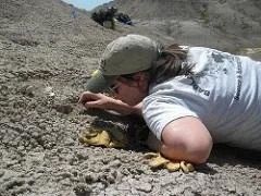
You are encouraged to look for fossils in Big Bend and enjoy the thrill of discovery. However, please leave the fossils in place for others to experience and study. We invite you to photograph your fossil finds and share your photos with a Park Ranger. Writing down a description of where you found the fossil is helpful, too. The fossils you discover may be the missing piece in our understanding of Big Bend’s rich paleontological history.

The history and the mystery of life on Earth
Why Fossils Matter
Life’s Origins
Fossils provide scientists with clues about the history and the mystery of life on Earth. Tiny bacteria fossils that can only be seen under special microscopes and huge dinosaur skeletons all can tell us about how the Earth has undergone physical change, and how life has adapted to these changes. Fossils allow scientists to understand how living plants and animals are related to one and other, and where extinct critters fit into the mix, too. Through the study of fossils by paleontologists, we can learn about origins and extinctions of life over nearly 3.5 billion years of Earth’s 4.6 billion-year history.
Protecting Our Planet
The great scientist Carl Sagan once said, “you have to know the past to know the present.” Fossils allow us to do just that. By studying extinction events in the past paleontologists are able to predict how extinction may affect organisms today, and be better prepared to face those challenges. Today, global warming threatens many species and ecosystems; we can turn to the fossil record to understand the implications of climate change, and from there we can work together on how to best protect our dynamic planet.

A Natural Laboratory
Fossils provide a window into past climates, landscapes, and ecosystems. Studying fossils can answer intriguing questions like why dinosaurs went extinct, where humans evolved, and how animals have migrated across the globe. Fossil can even help with understanding the timing of movements of Earth’s tectonic plates. They provide clues to how mountains and ice caps form as well as the rise and fall of the sea level. The National Parks provide an ideal natural laboratory to study the fossil record and to teach future generations the importance of these rare fossil resources.

Thank You!
This exhibit was made possible by the donations of generous supporters of the Big Bend Conservancy. Their legacy will continue to provide visitors with a world class exhibit experience for years to come.